
Climate risk is no longer a distant scenario. It is already visible in floods, damaged infrastructure, disrupted livelihoods and growing pressure on land and water systems.
Flood risk cannot be understood solely through water levels. Its impact depends on the exposure and vulnerability of people, infrastructure and ecosystems, as well as the capacity of communities and institutions to prepare and respond. For the 31st session of the Conference of the Parties (COP31) to the United Nations Framework Convention on Climate Change (UNFCCC), adaptation is already part of everyday climate reality.
COP 31 is expected to focus on turning climate commitments into action. Its Action Agenda highlights food security, climate-resilient cities, oceans and seas, Rio Synergy and the Climate Implementation Bridge, supported by finance, technology and capacity building. Flood risk belongs at the centre of this agenda. It shows whether planning, investment, ecosystems and institutions are ready for the climate conditions already unfolding.
A villager crosses the Batang Buat River by motorcycle in Lubuk Beringin village, Bungo district, Jambi province, Indonesia. Photo by Tri Saputro / Landscape Alliance
Flood risk needs systems diagnostics
When floods cause severe damage, public debate often points to a single dominant cause. However, flood risk reflects not only the physical hazard but also the exposure and vulnerability of affected communities. The extent of damage depends on how hazards interact with the exposure of people and assets and their vulnerability to harm.
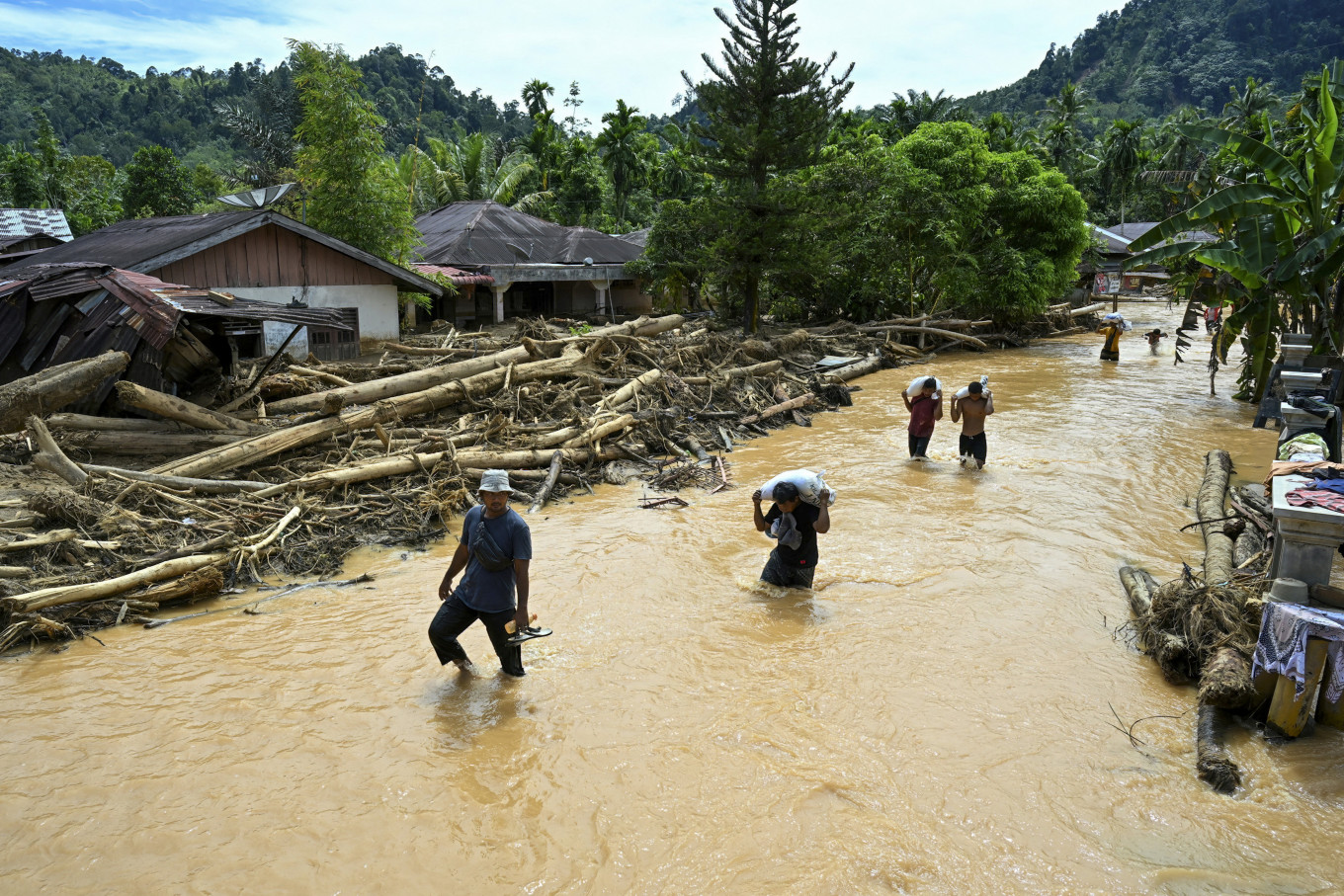
The November 2025 floods in Sumatra followed exceptional rainfall associated with interacting cyclones and warm ocean conditions. The white paper Flood risk, landscapes and adaptive capacity examines how these hazards interacted with landscape buffering, altered river morphology, exposure patterns, land use and governance across Sumatra. The impacts cannot be reduced to simple explanations such as “deforestation causes floods” or “climate change caused everything.”
This is a policy lesson for COP31. Adaptation plans need evidence-based diagnostics that identify where hazards are intensifying, where people and assets are exposed, why vulnerability persists and which institutions can act. Without this foundation, implementation risks becoming a collection of projects rather than a strategy for reducing risk.
The white paper, co-authored by Meine van Noordwijk, Beria Leimona, Fahmuddin Agus, Ali Yansyah Abdurrahim and Andree Ekadinata, recommends integrating disaster risk reduction (DRR) and climate adaptation around common evidence bases. This recognizes the work already done by DRR practitioners. Landscape-scale analysis, including geographic information systems (GIS) and light detection and ranging (LiDAR), helps map hazards, exposure and vulnerability. The policy challenge is to connect existing assessments with climate adaptation, land-use planning and forest governance.
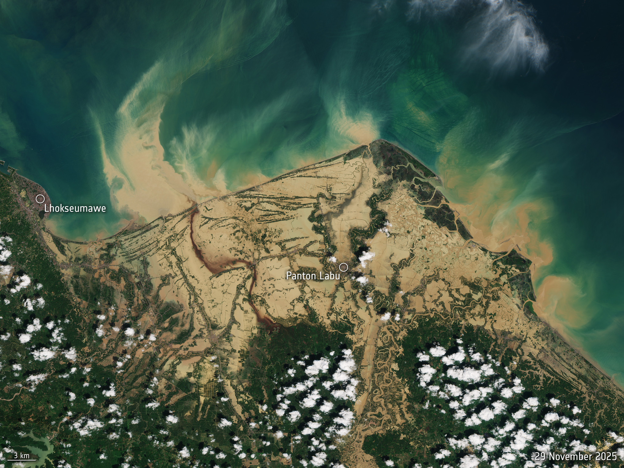
Contains modified Copernicus Sentinel data (2025), processed by ESA.
Adaptation begins with landscapes
Flood risk can be understood through three linked dimensions:
- hazard, the physical event;
- exposure, who or what is in harm’s way;
- and vulnerability, the susceptibility of people, infrastructure, institutions and ecosystems to harm.
This framing shows that adaptation is not only about controlling water. It is also about where people live, how land is managed, how rivers are given space, how infrastructure is planned and how communities receive warnings and support.
A landscape approach brings these factors together.
Vegetation and soil influence how rainfall is absorbed, stored, or converted into runoff. Forest conversion, compacted soils and rapid drainage can increase peak flows, while wetlands, agroforests, protective gardens, terraced agriculture and natural drainage features can help buffer risk when they are well managed.
For COP31, this strengthens the case for place-based adaptation. Global commitments must translate into watershed plans, land-use decisions, early warning systems and investments that reduce exposure and vulnerability. Restoration must also be functional. Planting trees alone is not enough; restoration must improve buffering, flow persistence, sediment control and resilience.
Water connects the COP31 agenda
Water is where many communities first experience climate change.
Too much water becomes a flood risk. Too little water becomes a drought risk. Water moving too fast becomes erosion and landslides. Water managed wisely becomes adaptation.
Flood impacts depend on how water moves through a landscape — across soils and vegetation, into rivers and drainage systems and toward settlements where risk accumulates. Food security depends on reliable water and resilient agricultural landscapes. Climate-resilient cities depend on flood-aware planning and upstream watershed management. Oceans and seas are shaped by what happens in rivers, coasts, wetlands and mangroves.
Forests matter, but function matters more
Forests matter because trees, roots, soils and vegetation influence infiltration, slope stability, rainfall recycling, cooling, runoff timing and landscape buffering. But forest cover alone does not determine flood outcomes.
What matters is how the whole landscape functions under pressure: how soils absorb rainfall, how vegetation slows runoff, how rivers carry sediment and debris and how land-use choices shape exposure downstream.
Forests can buffer rainfall and influence runoff, but these functions depend on how forests interact with other land uses and water systems.
The white paper recommends giving rivers more space and protecting or restoring wetlands, forest edges, protective gardens and natural drainage features. Tree counts and restored area can show the scale of an intervention; its contribution to landscape buffering, flow persistence and sediment control shows how it may reduce flood risk. Risk-informed land-use planning, including avoiding rebuilding in recognized high-risk locations, can also reduce exposure.
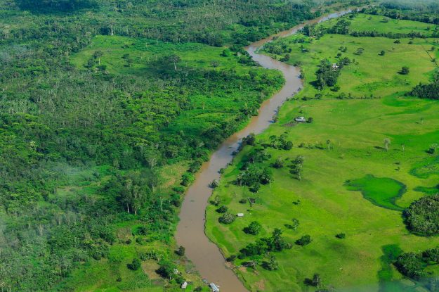
Sungang IV village on the riverbank in Banyuasin Regency, South Sumatra, Indonesia. Photo by Ricky Martin / Landscape Alliance
Adaptive capacity is an implementation target
Adaptive capacity is the ability of people, institutions and ecosystems to anticipate, absorb, recover from and adapt to hazards. It depends on governance, communication, local knowledge, tenure clarity, emergency preparedness and collective memory.
For COP31, adaptation must be workable in the places where climate impacts are already unfolding. Early warning systems need to reach communities and support action. Land-use plans need enforcement and public legitimacy. Restoration is more likely to last when local people help shape it and share its benefits.
Reducing flood risk requires investment in practical measures, including regional weather monitoring, forecasting and early warning systems that account for compound events and cross-border dynamics.
The publication also calls for climate-risk models that include land–atmosphere interactions, as well as infrastructure and emergency supplies to keep basic services and communications operating during extreme events. These measures depend on institutions having the resources and capacity to put them in place with affected communities.
A landscape lens for COP31
COP 31’s adaptation agenda will be tested in watersheds, floodplains, cities, farms, forests and coastal zones. Disaster risk reduction, climate adaptation, land-use planning and forest governance need to draw on shared evidence and direct policy and investment towards the hazards, exposure patterns and vulnerabilities identified in each watershed.
Join Dr Beria Leimona at COP 31
Dr Beria Leimona will join “Addressing the DRR Blindspots: Biodiversity and Ecosystems” at COP 31.
The session is part of the Resilient Cities and Built Environment theme and takes place Thursday, 12 November, from 10:00 to 10:50 a.m. at the Philippine Hub.