
Papua New Guinea’s Kokoda Trail, stretching from Port Moresby in the south to the village of Kokoda in the north, draws World War II history buffs and adventurous trekkers alike. The 96-kilometre (60-mile) track, first cut by goldminers in the 1890s, became the site of a desperate Australian battle with Japanese forces advancing from the northern coast. According to the National Museum of Australia, the Kokoda campaign marked a “crucial point in stopping the Japanese advance across the Pacific and towards Australia.” Yet about 50 kilometres southeast lies the far longer and harsher Ghost Mountain Trail in Papua New Guinea (PNG)—also known as the Kapa Kapa Track—an equally dramatic but largely forgotten wartime route.
The Ghost Mountain Trail cuts across the Owen Stanley Range from Gabagaba Village on PNG’s southern coast to Jaure in Oro Province. Dubbed “Kapa Kapa” by US soldiers—after mispronouncing Gabagaba—the 209-kilometre (130-mile) track rises to 2,700 metres (8,900 feet) through dense rainforest before descending onto the open grasslands of the Managalas Plateau.
In October 1942, more than 900 US troops of the 32nd Division set out to cross the mountains in an attempt to outflank Japanese forces on the Kokoda Track. What followed was one of the most punishing treks of the Pacific War. Military researcher and historian Samuel Milner later described the track as a succession of “razorbacks” so steep that soldiers had to climb on hands and knees, cutting footholds into the slopes with machetes and axes. Milner wrote in his 1957 book ‘Victory in Papua’:


“Immense ridges, or “razorbacks,” followed each other in succession like the teeth of a saw. As a rule, the only way the troops could get up these ridges, which were steeper than along the Kokoda Trail, was either on hands and knees or by cutting steps into them with axe and machete. To rest, the men leaned forward, holding on to vines and roots in order to keep themselves from slipping down the mountainside.”
The 42-day trek was extremely hard on the men’s bodies. The march left the soldiers ravaged by malaria, dengue fever, bush typhus, dysentery and infected skin sores. To better camouflage in the jungle, their khaki uniforms were dyed green—but the dye sealed the fabric, trapping heat and moisture and causing painful sores and infections. Boots rotted, medicines dissolved in the constant rain and canvas packs never dried.

“They went through waist-deep streams and along trails that were waist-deep channels of mud. Half the time, they could not see the sky—only matted leaves and vines. It would take five or six hours to go a mile, edging along cliff walls, hanging on to vines…There wasn’t any way of evacuating to the rear. The fear of being left behind drove everyone on… One group lost its footing and slid 2,000 feet (610 metres) downhill in 40 minutes; it took them eight hours to climb back to where they began.” – Major General Herbert W. Blakeley
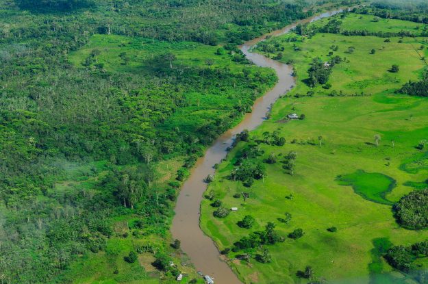
When the men finally staggered onto the flatter, more open terrain of Jaure in the Managalas Plateau—now a massive new conservation area—on the northern side of the mountains, only a quarter were to fight. “They were absolutely shot after that walk,” said Australian adventurer and trekker Peter Gamgee. “It’s estimated that only 25% of them were actually fit to fight; they were in a very bad way. They had not been trained for jungle warfare—or to walk through jungle at all; their initial training was for the battlefields of Europe and they got precious little of that anyway. So they were very unprepared. Their boots had rotted out by the time they got to Jaure.”
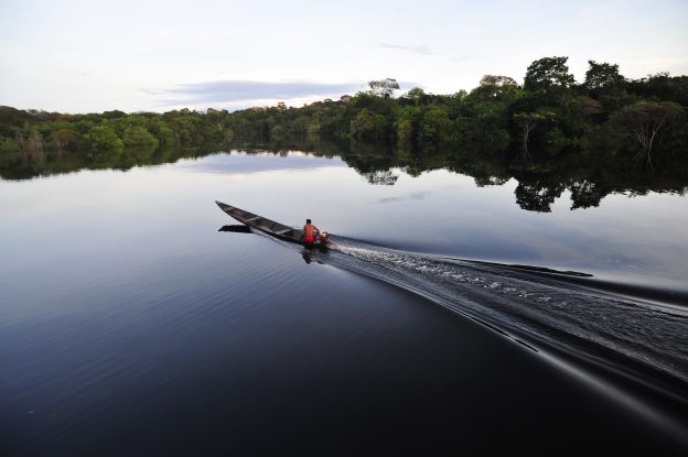
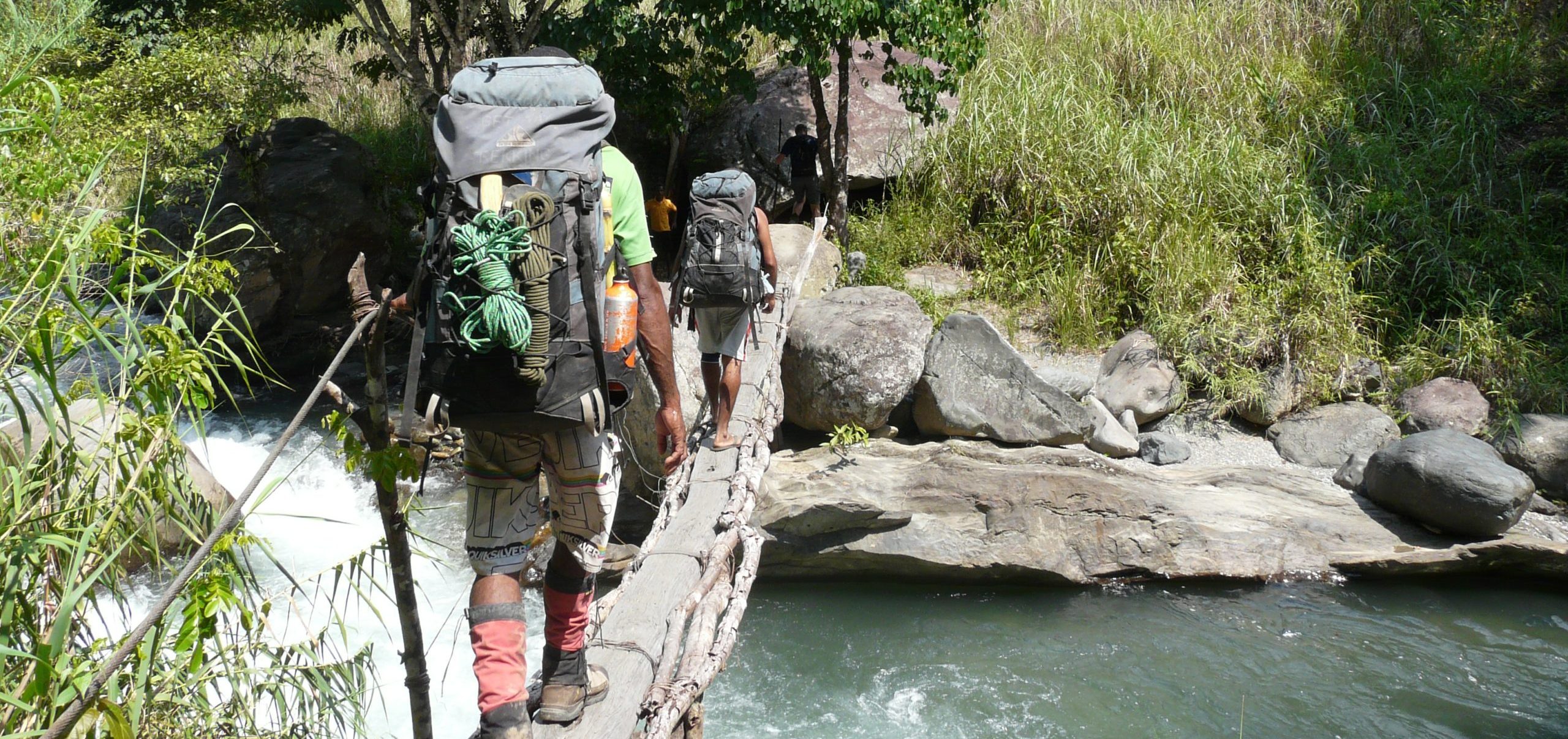
Worse still, the march was a failure. No Japanese came near the trail and because of the terrain, the troops were unable to support the Australians on the Kokoda Track. After a few days’ rest at Jaure, the men continued to the frontlines on the northern coast, where many died of their illnesses or were killed in battle. Ridgetop views on the Owen Stanley range from the Ghost Mountain Trail. Photo by Peter Gamgee
A forgotten trail, a living struggle
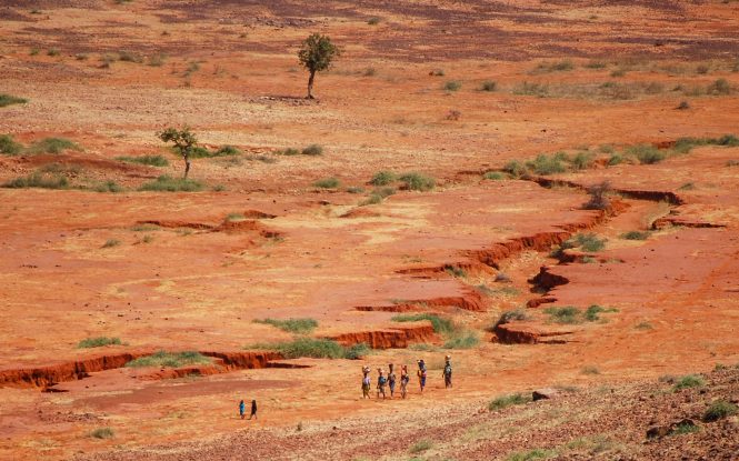
It’s a brutal story that demonstrates not only how unprepared the soldiers were for local conditions, but also how many rural Papua New Guineans still face similar challenges today: battling tropical diseases with limited resources and traversing rough, steep, risky terrain to reach basic services such as health care, education or markets for the crops and goods they produce.
After the war, the Ghost Mountain Trail fell into disuse. Locals occasionally ventured there to hunt, but many avoided it altogether, believing the place to be haunted. In the early 2000s, Gamgee grew curious about the track. “No one had any maps of it—there was very little record of it,” he said. Eventually, he located and walked part of the trail in 2009. “I was taken by the villages, how remote they really were from a lot of the services and things like that, and how they were suffering quite a bit,” he said.


“On the southern side [of the mountains] they once had a medical centre, pre-independence and it has since evaporated almost into nothing,” Gamgee added. “I myself have been affected by the unnecessary deaths of people I know in the area for want of basic medical care.”
Gamgee returned in 2011 with his son for a month-long traverse, later chronicling the experience in a book. Since then, he has guided several groups along the route. In 2022, he and a team of locals ventured off-track to locate the wreck of the Flying Dutchman, a transport aircraft that crashed into the mountainside in 1942 while carrying people and supplies to the northern coast. “My goal is not so much to build a trek, but to bring some help and support to those remote villages in a self-sustaining way,” he said.
Like Kokoda before it, the Ghost Mountain Trail has the potential to become a profitable trek-based eco-enterprise, particularly for those drawn by its wartime history. With the newly established Managalas Conservation Area (MCA)—through which the track runs—now developing a management plan that includes conservation-friendly livelihoods, the moment may be ripe to tap that potential.
“Tourism is one of several potential new value chains we are aiming to explore for Managalas,” said Will Unsworth, PNG project manager at the Center for International Forestry Research and World Agroforestry (CIFOR-ICRAF), which is supporting the development of the MCA with funding from the European Union. The organization has partnered with the provincial government and Northern Province Resources Limited to develop a tourism plan for the area.
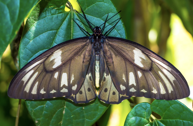
Beyond its rich history and vibrant culture, Managalas is also home to numerous rare endemic wildlife species, including the Queen Alexandra Birdwing Butterfly (Ornithoptera Alexandra), the largest known butterfly in the world. This blend of ecological, cultural and historical richness could prove a powerful attraction for visitors—offering adventure, remembrance, and a glimpse into the challenges that both the villagers of today and the 32nd Division soldiers of 80 years ago endured on the rugged Owen Stanley Range.
For more information on this project, please contact William Unsworth (CIFOR-ICRAF): w.unsworth@cifor-icraf.org